Understanding how to measure distance on a map is an essential skill to have when planning outings and expeditions. However, getting to grips with all the curvy lines and symbols can be a little daunting if you are new to map reading. Somehow they all translate into something real in the landscape in front of you, and knowing what’s what and where’s where will make or break your trip.
So try not to get distracted by all the pretty colours and shapes (as I often do!), as there is much to learn with many useful pieces of information hidden right in front of you, and learning how to measure distance on a map is easier than you might think.
Why is it so important to know how to measure distance on a map?
Not to be overly dramatic, but embarking on a hike or bike ride, or any journey for that matter, without knowing its distance could be the difference between life and death (depending on the journey of course!) So before you head out on your next trip into the unknown, make sure you know what you’re getting into by learning how to measure the distance on a map with these few simple steps:
- Choose the right type of map
- Identify the scale of your map
- Measure the route on your map with a ruler or piece of string
- Calculate the actual distance of the route
Here’s a little more detail to help you learn how to measure distance on a map:
Choose the right type of map
There are many different types of map, from atlases and ordnance surveys, to weather charts and topographic maps. Make sure the map you are using is suitable for the journey you are planning.
For cycling, walking or running, choose a map with lots of detail that doesn’t cover much more area than you intend to explore. For driving, choose a road atlas with less detail relating to the land, but more information on the road names and numbers etc.
Identify the scale on your map
Knowing the scale of a map will help you decide if it is the right map for the job. Scale is a way of indicating the relationship between a distance on the ground and its graphic equivalent on the map in front of you.
And just to make matters more complicated, there are also a few different ways to display scale:
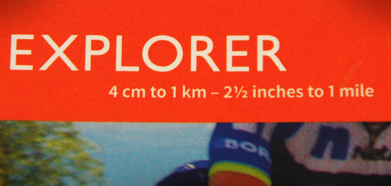
A ratio or representative fraction
This example means that every 1cm on the map equates to 0.25km on the land.
A graphic scale
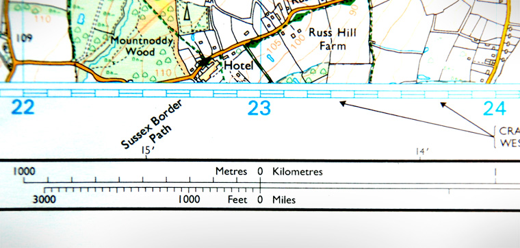
Usually found at the bottom of the map or in the legend (a box containing descriptions of all the images and symbols found on the map).
This example means that every 4cm grid square on the map equates to 1km on the land.
A word statement
How to measure distance on a map
Now that you’ve (hopefully) got your head around the different types of scales and how they relate to the actual route you are traveling on, you can now get down to measuring distance on a map that you have chosen to use.
Measure the route on your map
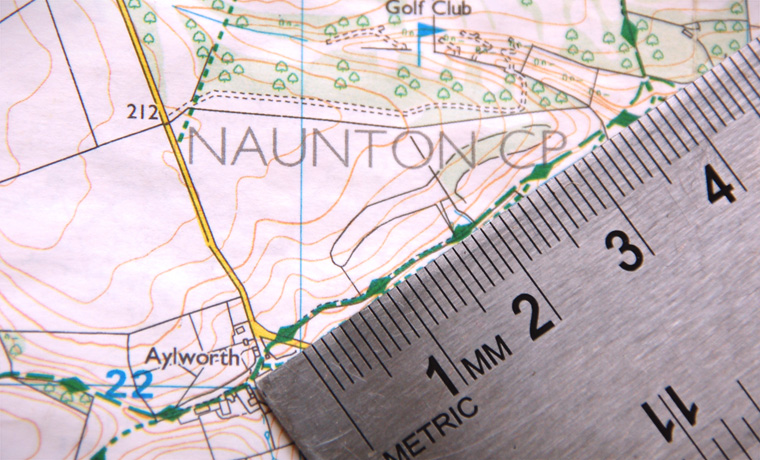
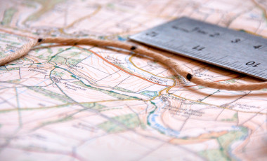
With a ruler – If the route you want to measure is fairly straight, then simply take a ruler and note the distance from A to B in cm.
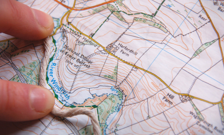
With a piece of string– If the route is bendy with lots of direction changes, then use a piece of string. Trace the route carefully with the string making marks on the string as you go if necessary.
Calculate the actual distance of the route
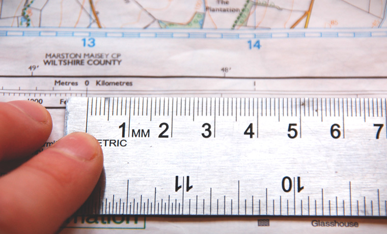
Once you know the distance in cm, you then need to look at your scale and convert it into miles or kilometres.
Eg: If a route measures 4cm on a map, and the the scale is 1:100 000 then the route is 4km long. There are different ways to calculate this, so have a read of this guide to get your head around it.
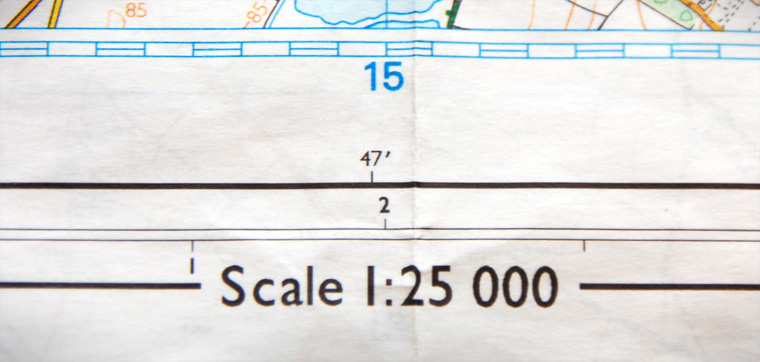
Alternatively, you can lay the string or ruler next to the graphic scale to measure the actual distance. On the example below, 4cm is equal to 1km. So the scale as a ratio is 1:25 000.
Measuring distance on a map out in the wild
Keep some string with you when you are out on your trip. There may be a point when you want or need to know how much further it is to the end of your journey (or to the next pub to stop for lunch!). Plans may change, and you may even find yourself on a part of the map that you didn’t really anticipate being on! As long as you are able to figure out where you are on the map, then you can use your newly learned knowledge of how to measure distance on a map to calculate the distance back to your planned route or the nearest landmark. So your next skill in map reading is to learn what all he symbols mean so you can truly practise measuring distance on map out in the wild.
