Dear BC,
You are exactly what your license plates boast: beautiful. Except that word isn’t enough to really describe you. I’ve found that no words can, and neither can photos, which is why you need to be experienced in order to truly understand why people attempt to describe you at all.
Love,
A captivated person.
Dear Captivated,
In order to experience me, you really should get out into my mountains. There is an endless network of trails leading to beautiful peaks, alpine meadows, clear lakes, and acres of forests to explore.
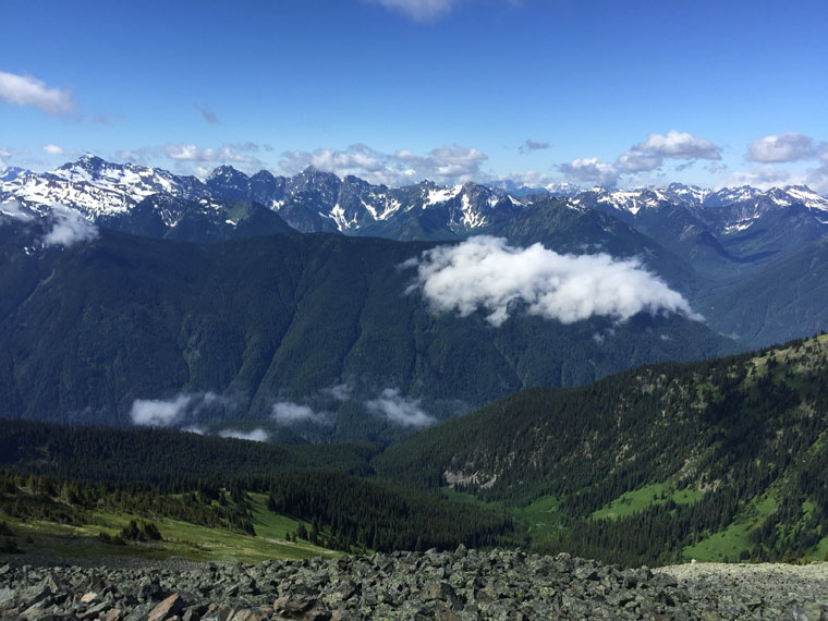
Skyline Trail II
Distance: 20km
For example, why not try the Skyline Trail II in E.C. Manning Park? If you’re driving through you’ll likely want to stop at Lightning Lakes anyways, and the trailhead is a short drive up the road from the first lake. This 20 kilometer hike is one way to get a bird’s eye view of some of the other lakes in the Lightning lakes chain, plus an endless sky full of craggy peaks in one direction and rolling mountains in the other. Once most of the elevation is gained, Skyline I is mainly a ridge walk and is a good mix of hillside meadows and alpine walks. Unless you want to do the 3 kilometer march back up the road from the bottom of the trail to where you park at Strawberry Flats, you’ll want to park a second vehicle at the bottom—all the more reason to take more people along!
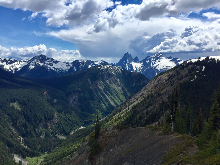
Mount Outram
Distance: 18km
Or, if you want more of a challenge and a peak to conquer, try Mt. Outram which is also in E. C. Manning Park. It isn’t near as well-trodden as the Skyline trail is and is a stunning way to get a workout. There’s a lake, a section of forest hiking, all the goodness of the alpine and lastly a rocky section where nothing stands in between you and the sky. It is an absolutely beautiful 18 kilometer hike! At the peak you are alone in a sea of mountains, steep slopes and green valleys. You can’t see the mountain from the #3 highway where the trail starts, but if you were on your way to Needle Peak on the Coquihalla highway, about 20 kilometers down the Sowaqua Creek Forest Service Road (off the Coquihalla) you can get a beautiful view of Mt. Outram’s impressive back side.
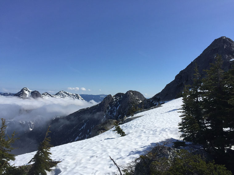
Needle Peak
Distance: 13km
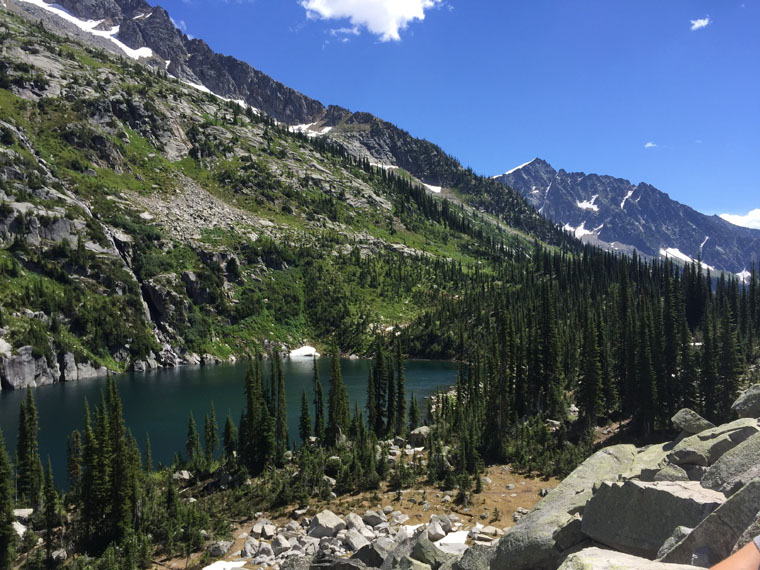
Along the Coquihalla, right before the mountains smooth out and become more gentle and full of pine trees, there are some impressive peaks that both visitors and residents can easily access and experience. Needle Peak is one of these and is definitely a favourite for Fraser Valley residents, with the final rocky scramble posing a fun challenge beyond the steady uphill slog of many hikes. It’s not easy to find the ‘trail’ for the last rock scrambling part but just pick your path according to what rocks you can reach to make your way up: as long as you’re heading up, there’s not much room for error! You can expect plenty of very interesting geology and nature to appear in front of you on this 13 km return hike: slabs of granite, flat peaks next to towering points, and wind shaped trees all give a sense of how powerful nature is.

Mount Laughington
Distance: 11km
Speaking of Fraser Valley residents, a very popular hike is Mt. Cheam, the Valley’s home mountain. But if you’re looking for a peaceful hike with unparalleled views of the Cheam range, summit Mt. Laughington. Although it is nearly as difficult to access the trailhead as the Mt. Cheam trailhead is, it’s a relaxing 11 km return hike for the most part. Once you’re through the magical alder tunnel which has taken over what was once an old logging road, the trail summits rocky hills and meanders on a ridge to the peak, with 360o views of the Chilliwack Lake valley on one side and the Cheam range on the other. On a clear day you can see parts of the Fraser Valley and Chilliwack from the peak. In the fall it is a kaleidoscope of rich colour in the alpine meadows with bright red blueberry plants and heathers coating many of the hillsides.
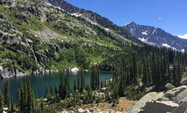
Kokanee Lake
Distance: 4km
If it’s a lake you’re looking for, the Kokanee Lake trail in Kokanee Glacier Park is phenomenal. There are wildflowers galore and the views on the trail are amazing before you even get to the lake. It’s relatively easy to access and isn’t a difficult 4 km roundtrip hike from Gibson Lake parking lot. There are some very friendly marmots in the area; they like to lick your arms and legs and will try beg a salty peanut or two from you. Alongside the well-worn trail there are multiple small waterfalls and rushing creeks fed by the clear, deep, cold lake; even mid-summer there are still pieces of ice floating around. The trail winds around the lake and continues on if you want to find a place to camp (which, by the way, I highly recommend you do!)
But enough about me: I’ll let you get out there and experience me for yourself!
Love,
Beautiful BC
For more detailed information and directions on these and more hikes, visit Club Tread. And to find out more about Sylvia, check her out on Istagram: @sylschaap
